Maps
Jump to navigation
Jump to search
Here you can find all the available Maps for Metrosimulator as well as some unreleased ones which are coming soon. To download maps offered separately click the link to the edition of the map you want.
| Key | ||
|---|---|---|
| Color | Meaning | |
| Pacific Green | Comes with the simulator | |
| Purple | Separate download needed | |
| Celery | Upcoming map | |
| Red | Only available with Beta 3.9 | |
Fictional
| Maps | |||
|---|---|---|---|
| Name & Map | Editions | Creator | Description |
Simvliet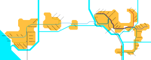
|
1982 | Michiel | RET Simvliet operates a Network consisting of four lines that split into branches of the main route off to the suburbs in coorperation with Randstadrail. |
| 2013 | |||
| 2017 | |||
| 2020 | |||
Rijndam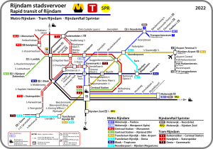
|
1985 | Sjoerd | Sjoerd's fictional city through the years, with its 7 metro lines, 4 tram lines, two suburban lines, many NS routes and more to explore (and drive) in the most diverse in MetroSim yet. Viaducts, sneltram, over and underground sections, special services such as the museum line, high speed lines and even an underwater tunnel connecting to the mainland, promise that metro and train drivers won't get bored. |
| 2006 | |||
| 2016 | |||
| 2018 | |||
| 2020 | |||
| 2022 | |||
| Railways 2022 | A version of Rijndam 2022 including only the railways for less powerful PCs | ||
| Metro 2022 | A version of Rijndam 2022 including only the metro network for less powerful PCs | ||
Arend Steam Railway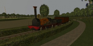
|
N/A | Sjoerd | A fictional railway park, using the 1839 Dutch steam locomotive Arend. |
Ferrocarril Funicular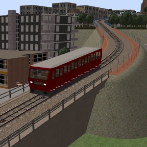
|
N/A | Sjoerd | The Ferrocarril Funicular is a short single track railway, transporting passengers up a hill to the city center. The gradient of the line varies between 8% and 12%. Two trains are operated, passing each other at the halfway station. Connected by a cable, they act as each other's counterweight, and therefore very little energy is required to operate the line. |
City of Thames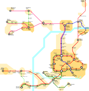
|
N/A | Michiel Sjoerd |
City of Thames is a fictional city based on London with a metro network based on the London Underground. It includes 2 sub-surface and 1 deep-tube line. |
Simtra Narrow Gauge Tram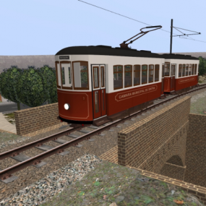
|
N/A | Sjoerd | The Simtra Narrow Gauge Tram is a fictional tramline (made for Metrosimulator 3.16) initially inspired on the Sintra tramline in Portugal. It is a single track line, mostly situated on the side of the road, with several passing loops along the line. Rolling stock included. |
Testingmap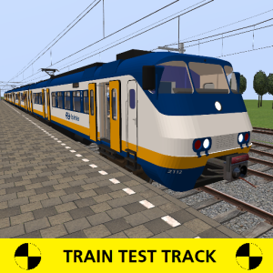
|
N/A | Sjoerd | A small map with 3 stations intended to test trains and metro's. |
Cablecar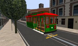
|
N/A | Sjoerd | This is a fictional cablecar network (made for Metrosimulator 3.17) consisting of two lines, inspired on the San Fransisco cablecar system. Rolling stock included. |
| Dutch National Rail Inspired |
Unknown | MG2 | National Rail map with National Rail rolling stock. Details to follow at a later time. |
Non-fictional
| Maps | ||||||
|---|---|---|---|---|---|---|
| Name | Editions | Creator | Description | |||
Rotterdam
|
1968 | Michiel | A map of the Rotterdam metro in 1968, to celebrate the network's opening, 50 years ago. | |||
Glasgow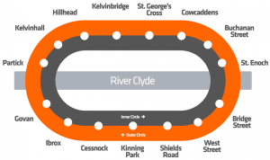
|
2020 | Sjoerd | Recreation of the Glasgow Subway, including maintenance trains and two generations of passenger rolling stock. | |||
Toronto Streetcar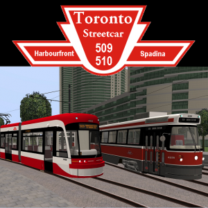
|
2019 | Sjoerd | 509 Harbourfront and 510 Spadina are streetcar routes in Toronto, Canada, operated by the Toronto Transit Commission (TTC). Line 509 has 12 stops, two of which underground, and line 510 has 18 stops, including three underground (a number of stops are shared between both lines). The package includes the appropriate rolling stock. | |||
Epping-Ongar Railway & Central Line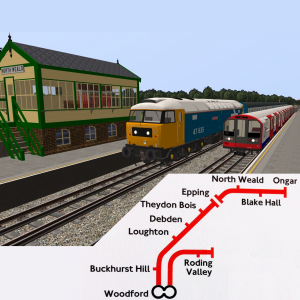
|
2021 | Sjoerd | The Epping-Ongar Railway is a heritage line north of London. It used to be part of the Central Line until its closure in 1994. Now the line is used by diesel and steam trains. From Epping, the Central line has been added until Woodford. The package includes the appropriate rolling stock. | |||
Lausanne Line M2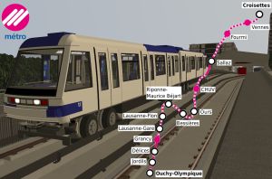
|
2023 | Sjoerd | Lausanne metroline M2. This is an automated line (manual driving is also possible) featuring platform edge doors at all stops. The package includes the appropriate rolling stock. | |||