MetroSimWiki
Jump to navigation
Jump to search


| Current Version | |
|---|---|
| Current version: | Beta 3.18.1 |
| Release date: | September 22th 2023 |
| Download | |
| What's new in Beta 3.18.1: | |
| • Better support for ATB-EG • Support for couplers with cover • Hagenngen tram platforms extended for RegioCitadis | |
| Featured Maps |
|---|
| Simvliet |
|---|
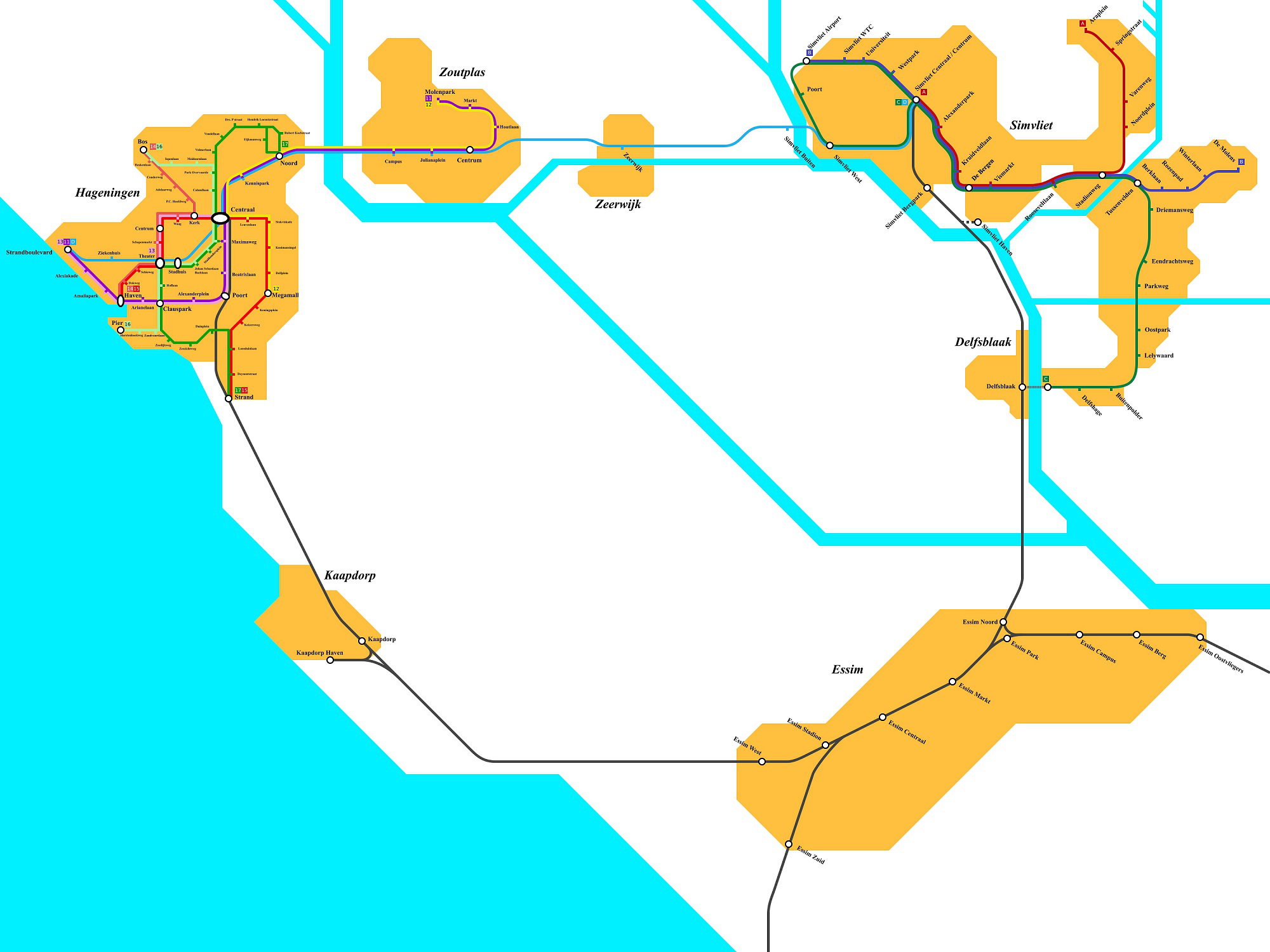
Simvliet is oldest of the currently available maps in the simulator. It includes a metro network with 4 lines as well as a tram network in the neighboring city of Hageningen, with 7 lines.
| Rijndam |
|---|
Rijndam is an island out of the coast of Simvliet with a network of 7 metro lines, 4 tram lines, Sprinter, Intercity, Intercity Direct NS lines and a channel tunnel that connects with mainland.
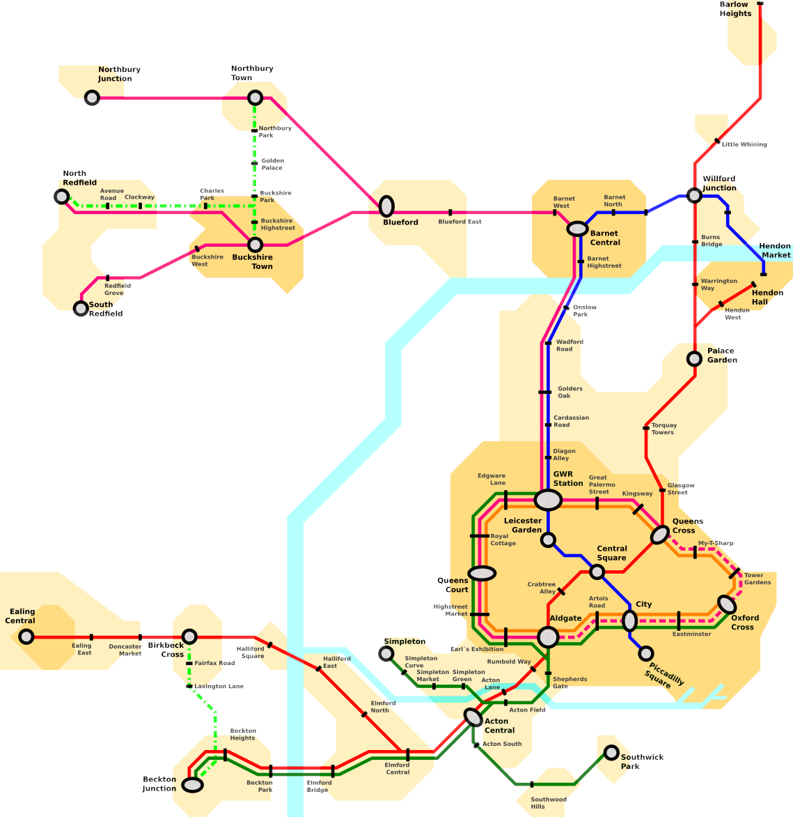
| City of Thames |
|---|
City of Thames is a fictional city inspired by London and contains (for now) 5 lines, 3 sub-surface (Green, Yellow and Purple) and 2 deep-tube (Red and Blue), with more coming in the near future.
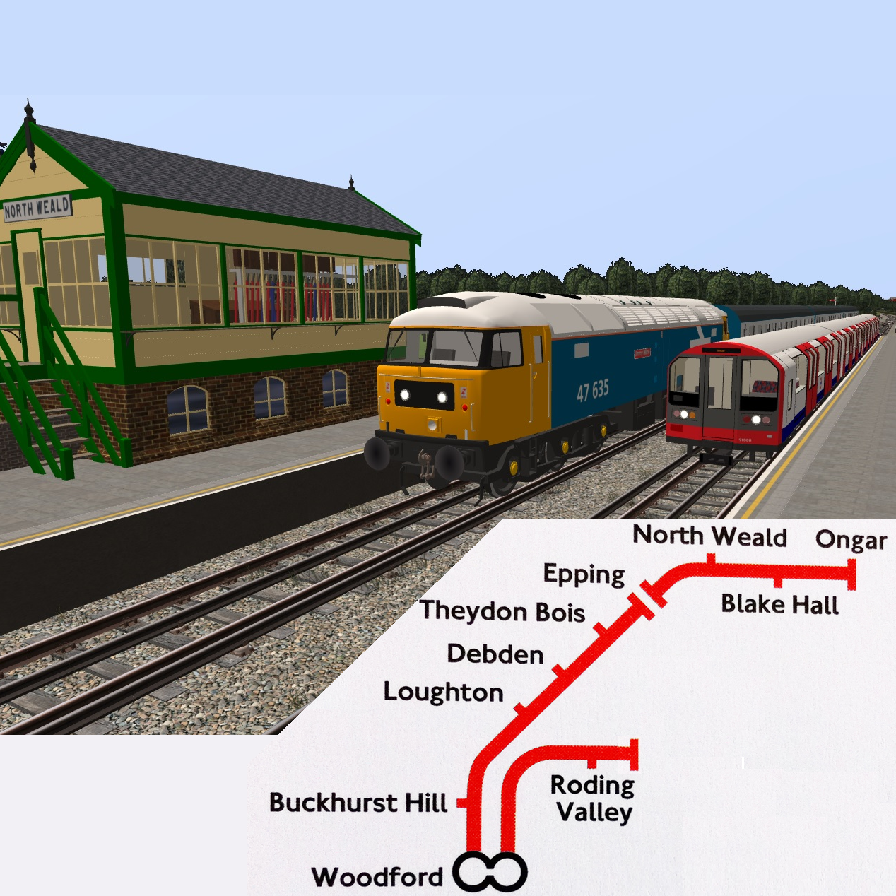
| Central Line: Woodford–Ongar |
|---|
A recreation of the northernmost section of the London Underground Central Line, from Woodford to Epping, including the heritage Epping-Ongar railway.
| Useful Links |
|---|
| Getting Started |
|---|
| Starting Tutorial |
| Driving Tutorial |
| CVL Tutorial |
| Rotterdam Metro Tutorial |
| Hageningen Trams Tutorial |
| Keyboard & Joystick |
| Other Tutorials |
| Readme |
| FAQs |
| Rolling Stock |
|---|
| Netherlands |
| Canada |
| Chile |
| France |
| Germany |
| Mexico |
| Portugal |
| Russia |
| Switzerland |
| United Kingdom |
| Maps |
|---|
| Fictional Maps |
| Non-fictional Maps |
| Security / Signalling Systems |
|---|
| ATB |
| LUSS |
| ROZ |
| ZUB |