He said Overground services will be available at GWR & Oxford Cross.... So, i don't think there's a National Rail...AlistairCowell wrote: ↑13 Aug 2023, 00:45 I hint the Grey Line running between Ealing Central and Oxford Circus, with the line separating to become Queens Cross and Piccadilly Square branches at Queens Court.
Another hint would be the London Overground running from Wilford Junction through to Ealing Central, and a National Rail between Ealing Central and GWR Station. Tramlink would be at my guess to run from Beckton Junction to Northbury Town and North Redfield.
Did nobody mentioned Waterloo & City inspired line yet (the Tourquose Line), operating between a Financial District and Main Line Railway station?
City of Thames map
Moderator: senjer
-
NJTFAN1235!
- Posts: 215
- Joined: 16 Apr 2023, 15:30
Re: City of Thames map
-
RotterdamMetroLover

- Posts: 729
- Joined: 23 Jan 2017, 15:21
- Location: Somewhere in this blue world.
Re: City of Thames map
What are you talking about? Of course there will be National Rail, but that's not shown on the map. Take a look for example at Ealing Central. The first 5 Platforms are for CTU (City of Thames Underground), while the other tracks are National Rail platforms. And it's not Oxford Cross, it's Queens Cross.
-
NJTFAN1235!
- Posts: 215
- Joined: 16 Apr 2023, 15:30
Re: City of Thames map
Ok, im getting lost here, 5 platforms? Im kinda confused, how do you even know there's a National Rail service foreshadowing?RotterdamMetroLover wrote: ↑13 Aug 2023, 10:22 What are you talking about? Of course there will be National Rail, but that's not shown on the map. Take a look for example at Ealing Central. The first 5 Platforms are for CTU (City of Thames Underground), while the other tracks are National Rail platforms. And it's not Oxford Cross, it's Queens Cross.
-
RotterdamMetroLover
- Posts: 729
- Joined: 23 Jan 2017, 15:21
- Location: Somewhere in this blue world.
Re: City of Thames map
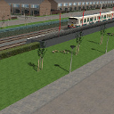
Take a look around the infrastructure around the station. From Platform 6 they have overhead wires. While Platform 1 thru 5 are powered by 3rd and 4th rail.
Re: City of Thames map
And on approaching GWR Station you can actually see the main line station building above you, which is obviously way larger than it would be for just the Overground.
-
RotterdamMetroLover
- Posts: 729
- Joined: 23 Jan 2017, 15:21
- Location: Somewhere in this blue world.
Re: City of Thames map
Looking back at Ealing Central I saw that platform 1 thru 3 have 3 aspect signals whilst platforms 4 and 5 have 2 aspect signals. My guess is that the some overground services share the same track as the Grey Line between Ealing Central and an unknown station. I could be wrong.
Re: City of Thames map
Yes you are wrong  Those are red-white-green aspect signals like on the Central Line.
-
NJTFAN1235!
- Posts: 215
- Joined: 16 Apr 2023, 15:30
Re: City of Thames map
Ok, it's kinda getting even more confusing for me...... the Overground, National Rail, too many problems that even i couldn't keep track of services....... i get that Purple Line & Blue Line will both join the gang of Thames, with new places to explore for us to see, new aspects we will find, more express and local action, but National Rail? I am at severe loss of words...........
-
alexandru987
- Posts: 205
- Joined: 28 Apr 2020, 18:05
- Location: Walthamstow ,England