Rijndam
Posted: 24 Sep 2016, 10:25
You have already seen some screenshots in the screenshot topic; there is a new route in production. I think it is time to tell you something about this.
I am building a new fictional metro network under the name "Rijndam". It might seem this name was chosen to fit the "R" in RET (the transport company of Rotterdam), but this is not the case (it is just a conviniënt coincidence). The name Rijndam (Rhinedam for Englisch speakers) was inspired by the idea "What might my home city (Leiden) be called if it where named in the same way as the two cities in the Netherlands with metro networks?
Although the name of the metronetwork is inspired on the city Leiden, the similarity ends there; there are a few exceptions (names of a few of the stops), but the network is not based on Leiden. It is inspired by elements of the metro network of Rotterdam and the prémetro network of Charleroi. The Charleroi element is the use of a city centre loop, with branches into the suburbs.
The network has four lines:
M1: Molenwijk - Panbos
M2: Central Station - Monument
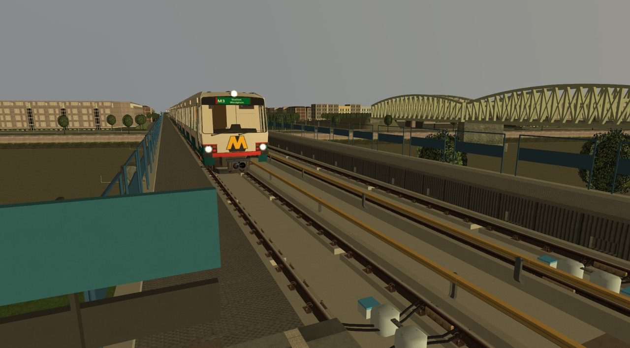
M3: Central Station - Rijnland Ziekenhuis (Rijnland Hospital)
M4: Central Station - Rijndam Airport

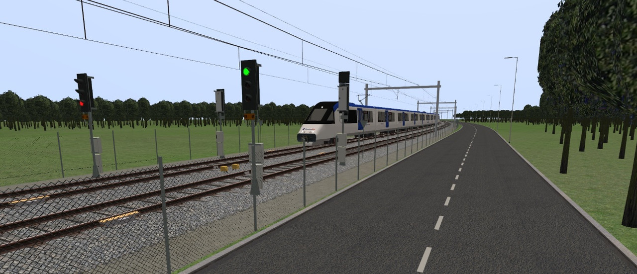
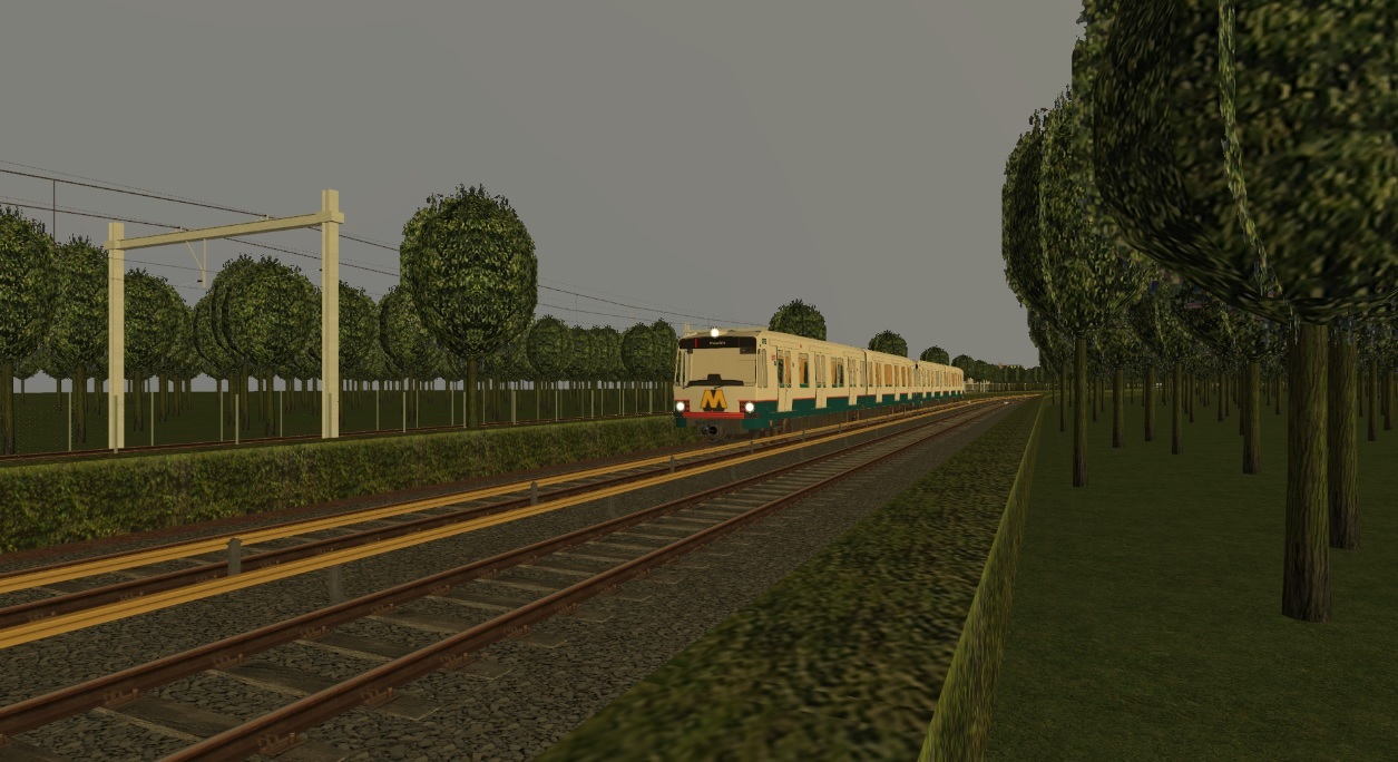
The parts Noorderpoort (Northern gate) - Panbos (on line M1) and Noorderpoort - Rijndam Airport (line M4) are build as former local railways, and are equipped with overhead whires and ZUB train protection. The citycouncil of Rijndam has linked these lines to the metro network, so they could increase services on the lines and re-develop the site of the former Rijndam Noorderpoort trainstation into a business district.
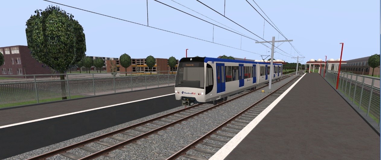
Line M1 is a single track line beyond Noordvliet, with a passing station at Rijnwoude Dorp.
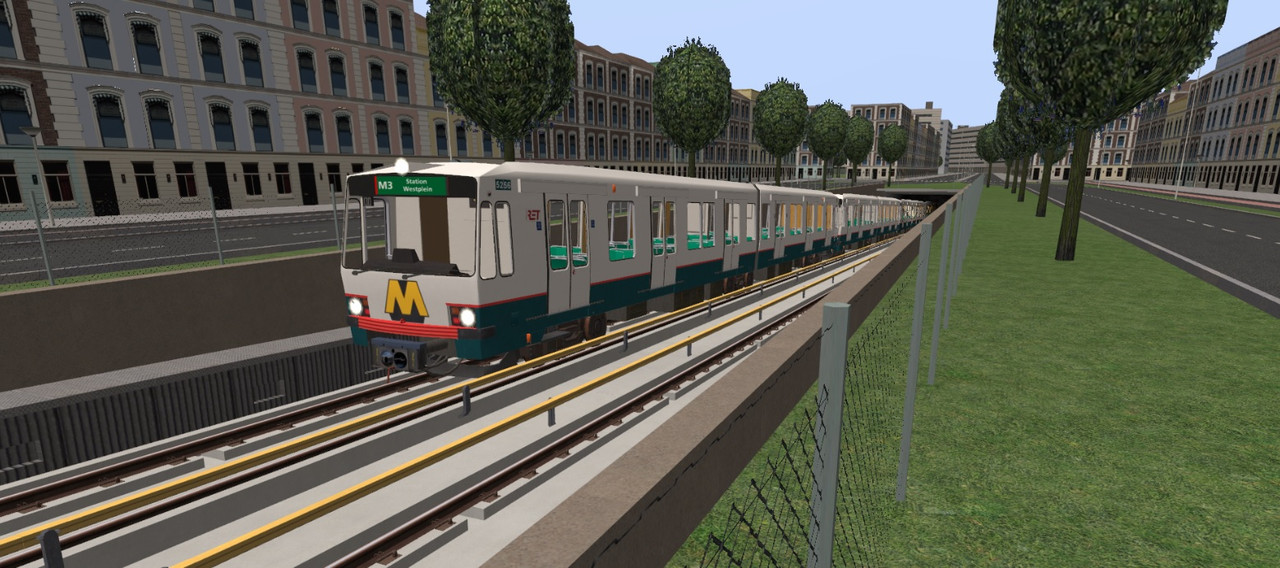
The lines M2 and M3 continue from Station Westplein (station western square) as Sneltram (overhead whires and level crossings) to their destinations Monument and Rijnland Ziekenhuis. At the central station, these lines connect to each other (a line M2 metro continues as line M3 and vice versa), so all stations on the city centre loop can be reached without passengers needing to change trains.
Line M4 uses the city centre loop counter-clockwise; this way, all city centre loop stops have a direct connection to and from the airport. From Noorderpoort to the airport, line M4 runs under ZUB train protection.
The entire city centre loop, as well as one station out on each of the branches, is build underground. The rest is on the surface, except for the airport station; line M4 goes underground again shortly before arriving at the airport.
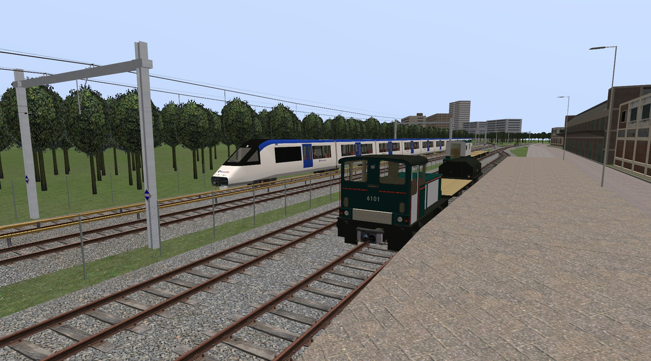
The network has 3 depots; the main depot at Molenwijk (with a railway connection), a converted freightyard near Station Westplein, and a smal depot at the airport.
And finally there is a transport museum in order to display the oldest metro's. This museum lies at some distance from the nearest metro station. Therefore, there is a short museumline where museum metro's can shuttle visitors to the museum. This line has been build as a former freight connection along the former railway (now metro) to Panbos. This is in ZUB controlled territory, but the museumline has been equipped as an 'ATB island' (and with 3rd rail) in order to run the old metro's.
Here are the screenshots you have aready seen:
http://s26.postimg.cc/ya5wvo6o9/Rd23.jpg
http://s26.postimg.cc/k91qfh32h/Rd_PNB.jpg
http://s26.postimg.cc/ouqi1u5l5/Rd25.jpg
And here are some you haven't seen yet:
I am building a new fictional metro network under the name "Rijndam". It might seem this name was chosen to fit the "R" in RET (the transport company of Rotterdam), but this is not the case (it is just a conviniënt coincidence). The name Rijndam (Rhinedam for Englisch speakers) was inspired by the idea "What might my home city (Leiden) be called if it where named in the same way as the two cities in the Netherlands with metro networks?
Although the name of the metronetwork is inspired on the city Leiden, the similarity ends there; there are a few exceptions (names of a few of the stops), but the network is not based on Leiden. It is inspired by elements of the metro network of Rotterdam and the prémetro network of Charleroi. The Charleroi element is the use of a city centre loop, with branches into the suburbs.
The network has four lines:
M1: Molenwijk - Panbos
M2: Central Station - Monument
M3: Central Station - Rijnland Ziekenhuis (Rijnland Hospital)
M4: Central Station - Rijndam Airport
The parts Noorderpoort (Northern gate) - Panbos (on line M1) and Noorderpoort - Rijndam Airport (line M4) are build as former local railways, and are equipped with overhead whires and ZUB train protection. The citycouncil of Rijndam has linked these lines to the metro network, so they could increase services on the lines and re-develop the site of the former Rijndam Noorderpoort trainstation into a business district.
Line M1 is a single track line beyond Noordvliet, with a passing station at Rijnwoude Dorp.
The lines M2 and M3 continue from Station Westplein (station western square) as Sneltram (overhead whires and level crossings) to their destinations Monument and Rijnland Ziekenhuis. At the central station, these lines connect to each other (a line M2 metro continues as line M3 and vice versa), so all stations on the city centre loop can be reached without passengers needing to change trains.
Line M4 uses the city centre loop counter-clockwise; this way, all city centre loop stops have a direct connection to and from the airport. From Noorderpoort to the airport, line M4 runs under ZUB train protection.
The entire city centre loop, as well as one station out on each of the branches, is build underground. The rest is on the surface, except for the airport station; line M4 goes underground again shortly before arriving at the airport.
The network has 3 depots; the main depot at Molenwijk (with a railway connection), a converted freightyard near Station Westplein, and a smal depot at the airport.
And finally there is a transport museum in order to display the oldest metro's. This museum lies at some distance from the nearest metro station. Therefore, there is a short museumline where museum metro's can shuttle visitors to the museum. This line has been build as a former freight connection along the former railway (now metro) to Panbos. This is in ZUB controlled territory, but the museumline has been equipped as an 'ATB island' (and with 3rd rail) in order to run the old metro's.
Here are the screenshots you have aready seen:
http://s26.postimg.cc/ya5wvo6o9/Rd23.jpg
http://s26.postimg.cc/k91qfh32h/Rd_PNB.jpg
http://s26.postimg.cc/ouqi1u5l5/Rd25.jpg
And here are some you haven't seen yet: