I've been a fan of the map Rijndam since it first came out (and of the game itself for much longer), thus you can imagine my happiness as I randomly checked the website yesterday just to see the new version available for download. But there is one thing I always kinda disliked: The network maps. They are great in terms of functionality but not in terms of design in my opinion, so I decided to make new ones for every map version (and a bonus one for 1995 since I didn't want such a large gap between 1985 and 2006). Some of you will probably notice a few design similarities to another European rapid transit network - but only probably
Oh and by the way, I don't speak Dutch unfortunately, so I had to use Google Translate for all kinds of texts. I hope it did a good job, if there are language mistakes (or if one would normally put something entirely different) please tell me so I can correct it
Here's the rundown from 1985 to 2020:
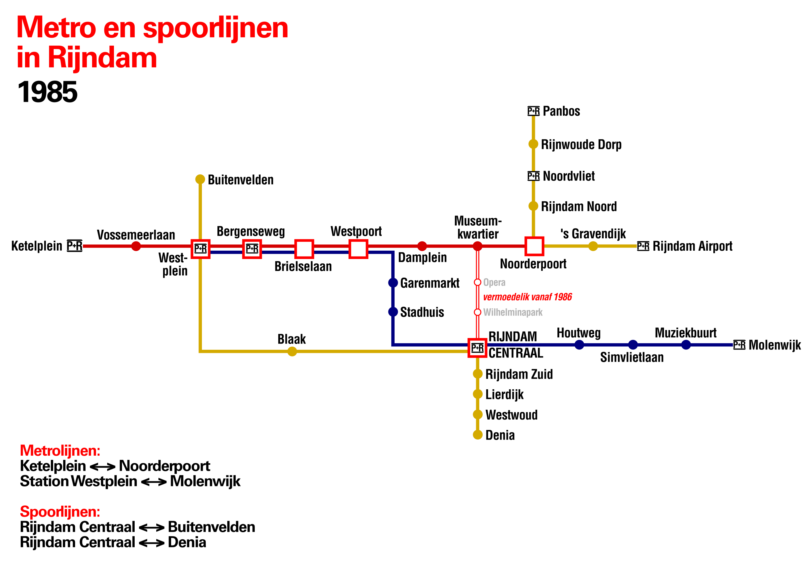 1985 - with the city loop still under construction (maybe 1986 is a bit too early considering there is no work to see at CS) and no mentioning of an M3, let alone any route number.
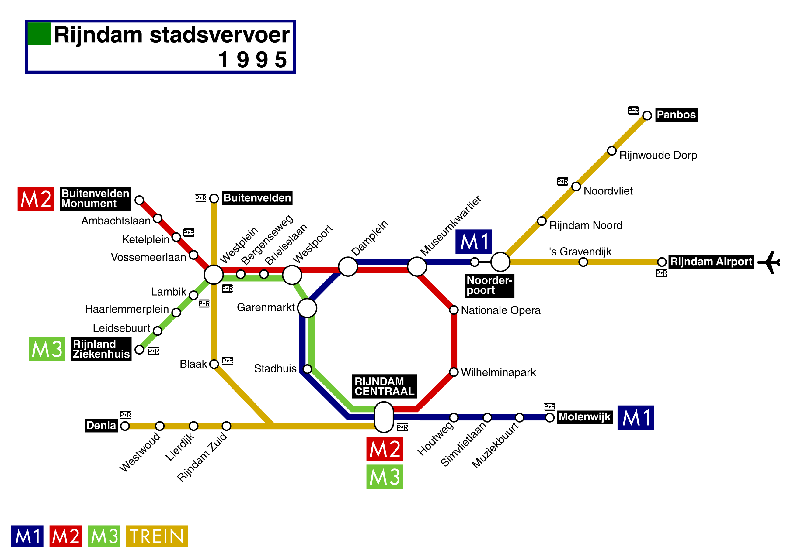 1995 - with the Metro network in its full extension until 2006. Probably right after the opening of the M3 to RZKH.
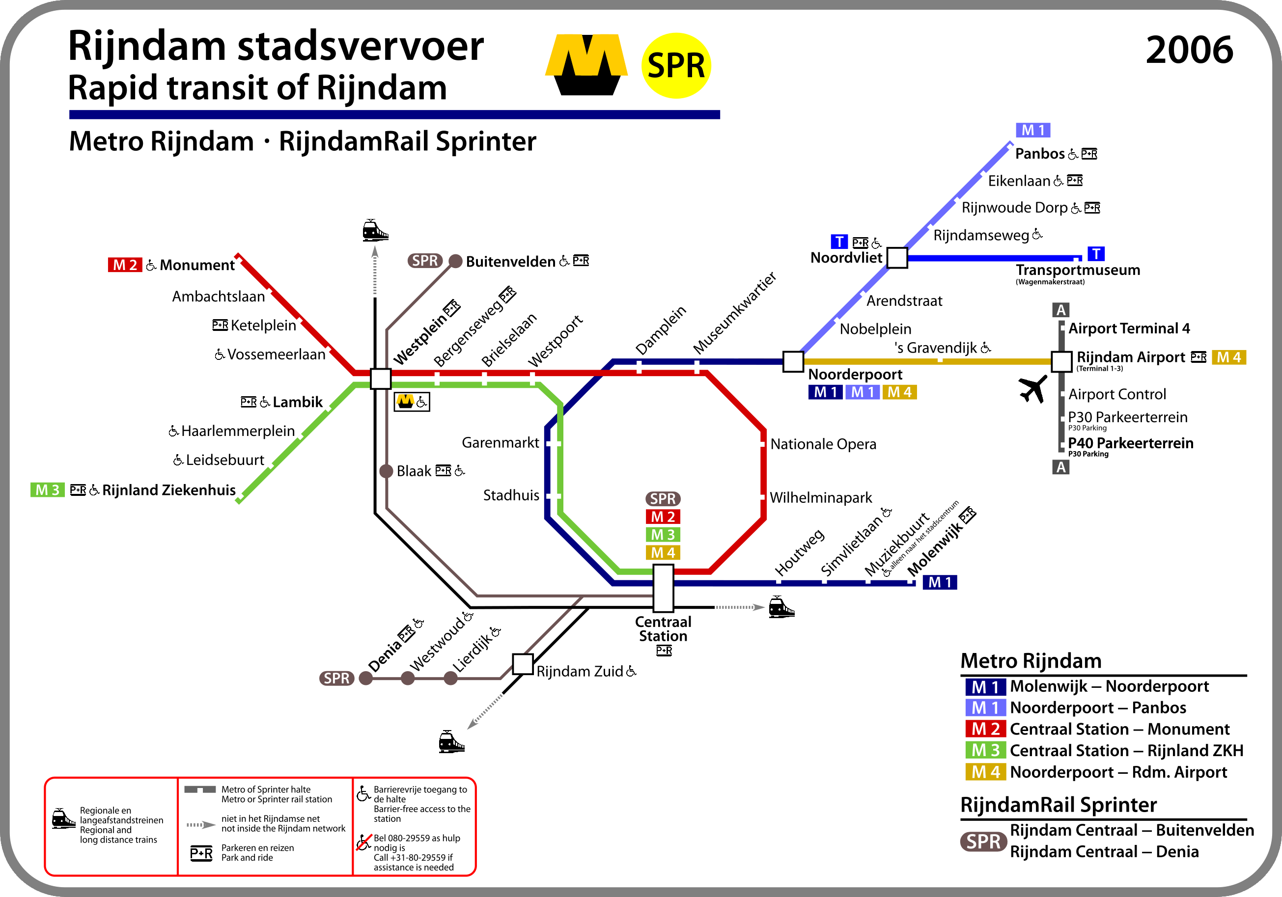 2006 - the RijndamRail Sprinter is a thing, as well as the extension of the M1 and the M4 in their "early stage". Oh and there's also the Airport Shuttle.
 2016 - Sprinter service is temporarily suspended, the M1 to Panbos and the M4 have been fully incorporated into the network.
 2018 - Sprinter service is restored and extended until Noordvliet, the new Metro to Transferium Rijndijk and Denia is in service.
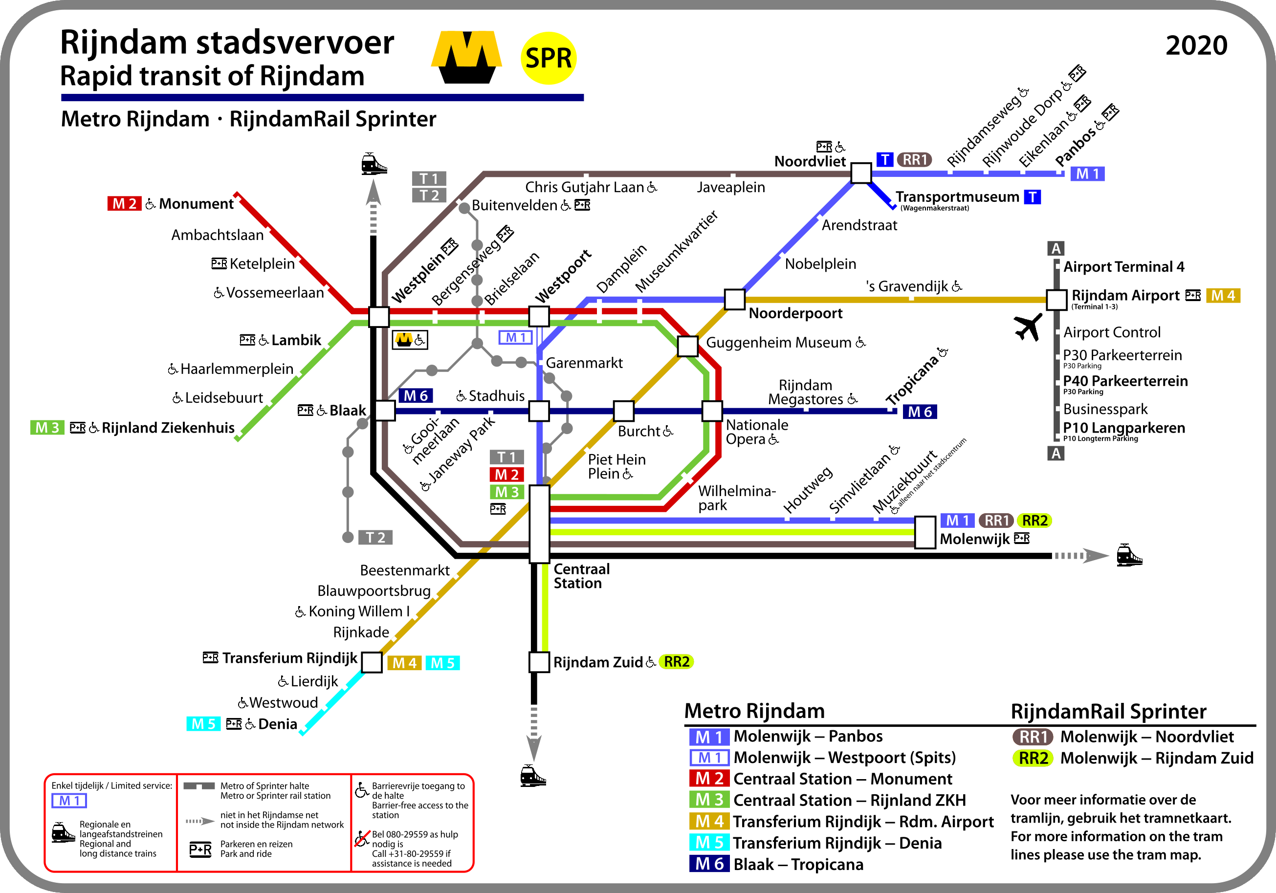 2020 - new routes cutting through the loop and the all-new tram, which got its own map for better clarity.
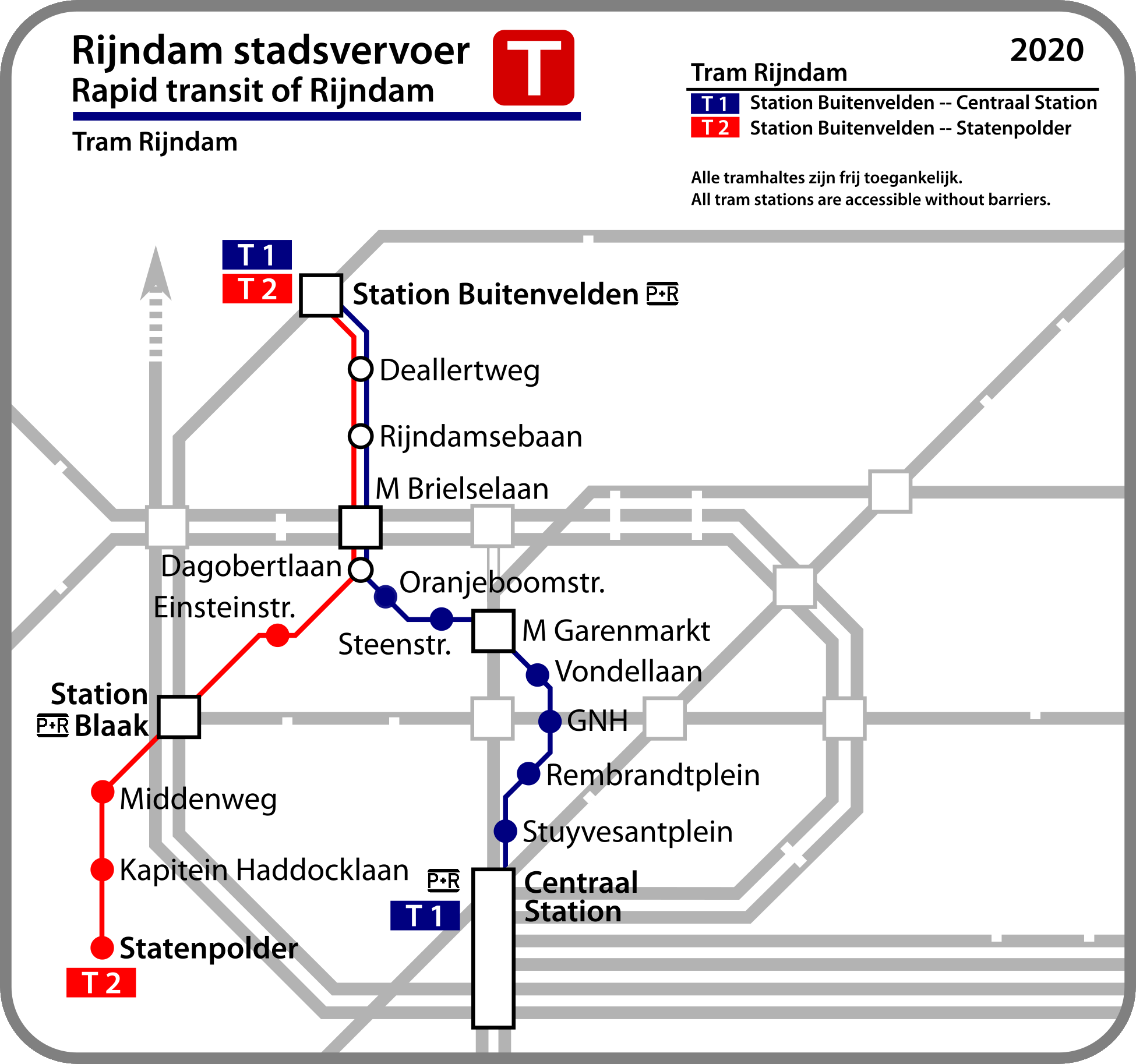 Tram 2020 - well, there's not much to say about this one.
I hope you guys like my work
Best regards
DT3-LZB


